
These maps are speculative drawings based in information we have gathered from the Macpherson proposals. E&B oil has not submitted their drilling proposal yet.
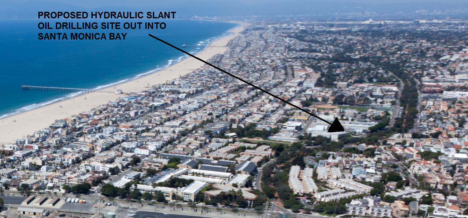

Map of the proposed Hermosa Beach slant oil drilling site will reach out into the ocean. What is slant oil drilling? The drilling will also go underground into Redondo Beach likely. The California Coastal Commission has full authority of this drilling and has thus tidelands restrictions on where money from oil can be spent. The oil site will also be less than 100 feet from homes when Colorado requires a 350 foot setback and California recommend 300 feet.
Do we really know what is underground nor want to disturb the environment with oil drilling pipes possibly poking through the ocean floor? Do want want to risk the dangers of the ocean floor and our beaches sinking (subsiding)?
Do we really know what is underground nor want to disturb the environment with oil drilling pipes possibly poking through the ocean floor? Do want want to risk the dangers of the ocean floor and our beaches sinking (subsiding)?

The proposed drilling site effects more than 50% of residents of Hermosa Beach. Noise, air pollution, explosions or dangerous gases are all a potential consequence. Not to mention the drilling site will be within a few hundred yards of your kids playing in the park. If you run on the greenbelt in Manhattan Beach or Hermosa Beach there could be an oil pipeline to under it to Chevron Refinery in Torrance and/or a natural gas pipeline AES Power Plant in Redondo Beach.


Lets not forget about the fault line that runs across the Santa Monica Bay and the South Bay. We have had several earthquakes offshore in Hermosa Beach and Santa Moncia bay in the past few years.


27 oil wells and 3 water injection wells for Fracking and Natural Gas
 |
| Horrible Air Quality |
Emissions generated during the drilling/development phase include vehicle emissions; diesel emissions from large construction equipment and generators, storage/dispensing of fuels, and, if installed at this stage, flare stacks; small amounts of carbon monoxide, nitrogen oxides, and particulates from blasting activities; and dust from many sources, such as disturbing and moving soils (clearing, grading, excavating, trenching, backfilling, dumping, and truck and equipment traffic), mixing concrete, and drilling. During windless conditions (especially in areas of thermal inversion), project-related odors may be detectable at more than a mile from the source. Excess increases in dust could decrease forage palatability for wildlife and livestock and increase the potential for dust pneumonia. See source.

250 Yard Heavy Impact Zone from Noise, Odor, Dangerous Gases and Explosions. There are two parks, hundreds of homes and a jogging trail in the vicinity which I think is disgraceful. There are probably 10+ kids under the age of 10 years old that live in the red boxed area. Its just sad that no one thought through the ramifications.

Projected Ripple Affect of Real Estate Losses
This is a Scenario of What Could Happen


